Our Services
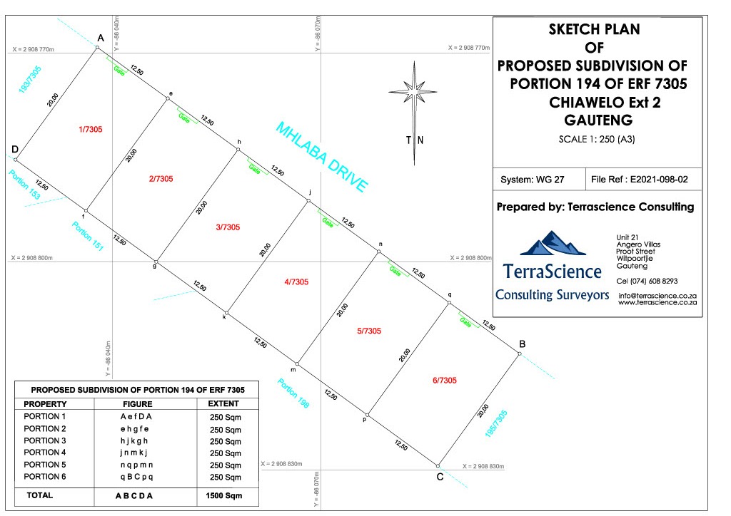
Cadastral and Sectional Title Surveys
- Township Establishment surveys
- Subdivision surveys
- Consolidation diagrams
- Lease surveys
- Beacon Relocations or Replacement surveys
- Boundary disputes and resolution
- Sectional Title surveys
- Encroachment investigation surveys
Engineering Surveys
-
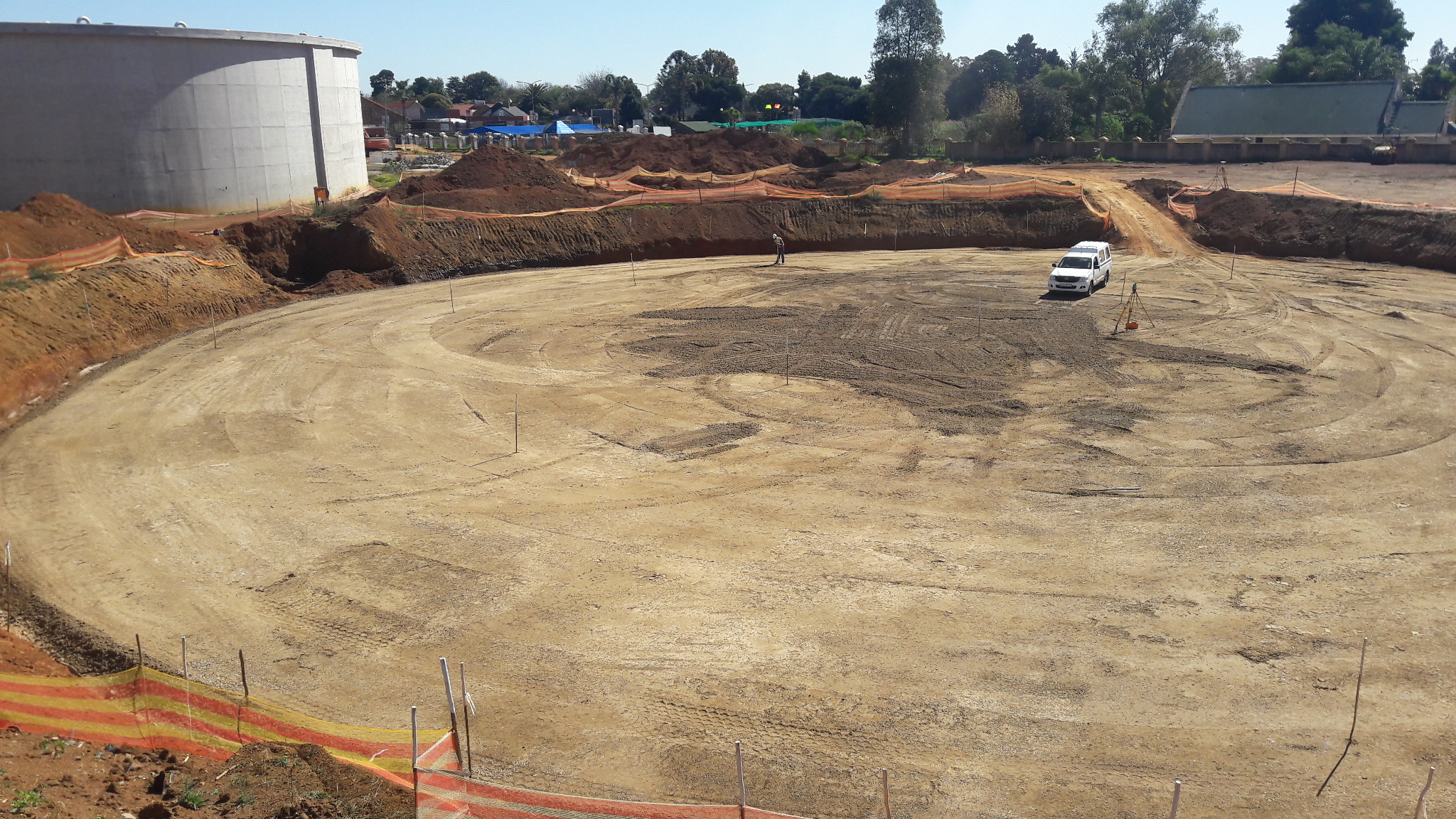
Construction Surveys
- Site Survey benchmarks/Control establishment
- Earthworks (Dam walls, platforms, foundations)
-
Setting surveys of Roads, railway lines, bridges,
culverts, powerlines surveys, building, pipelines, fibre
lines, photo voltaic solar plants and Mine
infrastructure.
-
Concrete Civil works (Plinths, HD Bolts, formworks)
- Pipelines, conveyors and Canals
-
Periodic volumetric survey for the purpose of claims
- Earthworks quantity disputes
- Monitoring of construction quality
- As-built surveys
-
Topographic Surveys
- Digital Terrain Modelling and contour mapping
- Site control Establishment
-
Detail Surveys (Fence lines, sewer networks, stormwater
etc)
-
Structural deformation monitoring
-
Deformation and monitoring surveys of Bridges, high rise
buildings, dam walls, water towers and reservoir
-
Turnkey Projects
-
Design proposal for approval by the engineer for: Roads,
Railway lines, Bridges, Dam walls, Sewer and water
reticulation networks.
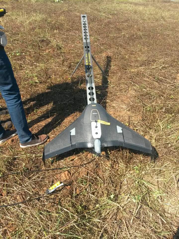
Aerial Surveys
-
LiDAR
- Topographical and micro topography mapping
-
3D mapping using LiDAR data to create DEMs, DSMs, and
DTMs in conjunction with high resolution orthoimages
- Aerial and Terrestrial scanning
- Roadway mapping
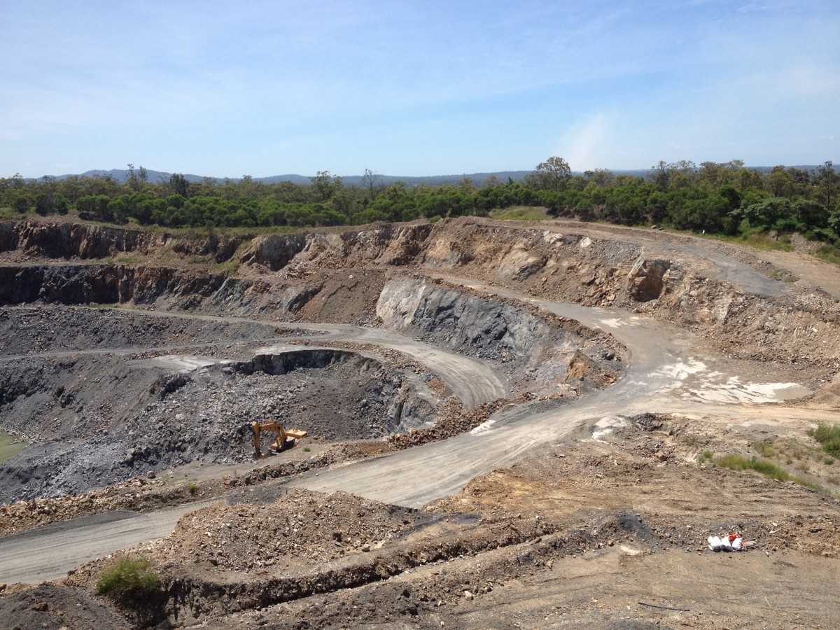
Mine Surveys
- Establishment of open cast mine survey control
- Periodic volumetric survey and calculations
-
Stockpile and excavation surveys calculation of quantities
- Setting out of exploration boreholes
- Setting out of blast pattern
- Movement Monitoring Surveys
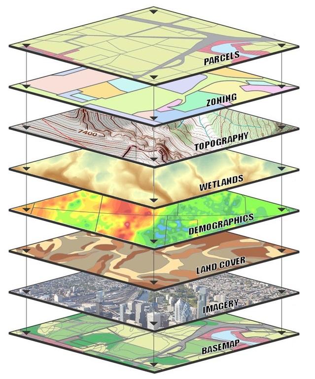
Geographical Information Systems (GIS)
-
Data management - conversion of raster and vector data,
projection conversions, editing and updating of data
-
Spatial Analysis - multi-criteria analysis for site
suitability, habitat modelling, Network analysis, spatial
patterns, digital elevation modelling
- Spatial Statistics
- Habitat suitability modelling
- Natural disaster mapping
- Flood analysis
- Raster and vector workflows
- Projections
- Image processing
-
Utility mapping (fibre optic lines, powerlines, water,
sewer, and gas lines)
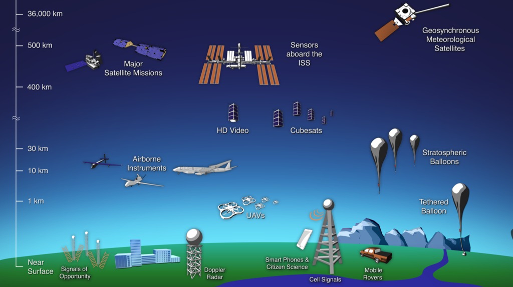
Remote Sensing
- Landsat, Sentinel, RapidEye, WorldView, etc.
- Image classification and feature extraction
- Machine learning models for land cover classification
- LiDAR processing
- Change detection
-
Image pre-processing: orthorectification, atmospheric
correction, radiometric normalization, mosaicking & colour
balancing
- Image Classification
- Biomass modelling, estimation and monitoring
- Field data collection
- Model validation and accuracy assessment
-
LiDAR data analyses for applications in forestry, flood
inundation mapping, vegetation change assessment
- Environment assessment
- Flood mapping and modelling
- Ecological and land classification
- Pollutant modelling
- Road mapping
- Viewshed analysis
- Urban utility mapping
- Structural deformation surveys
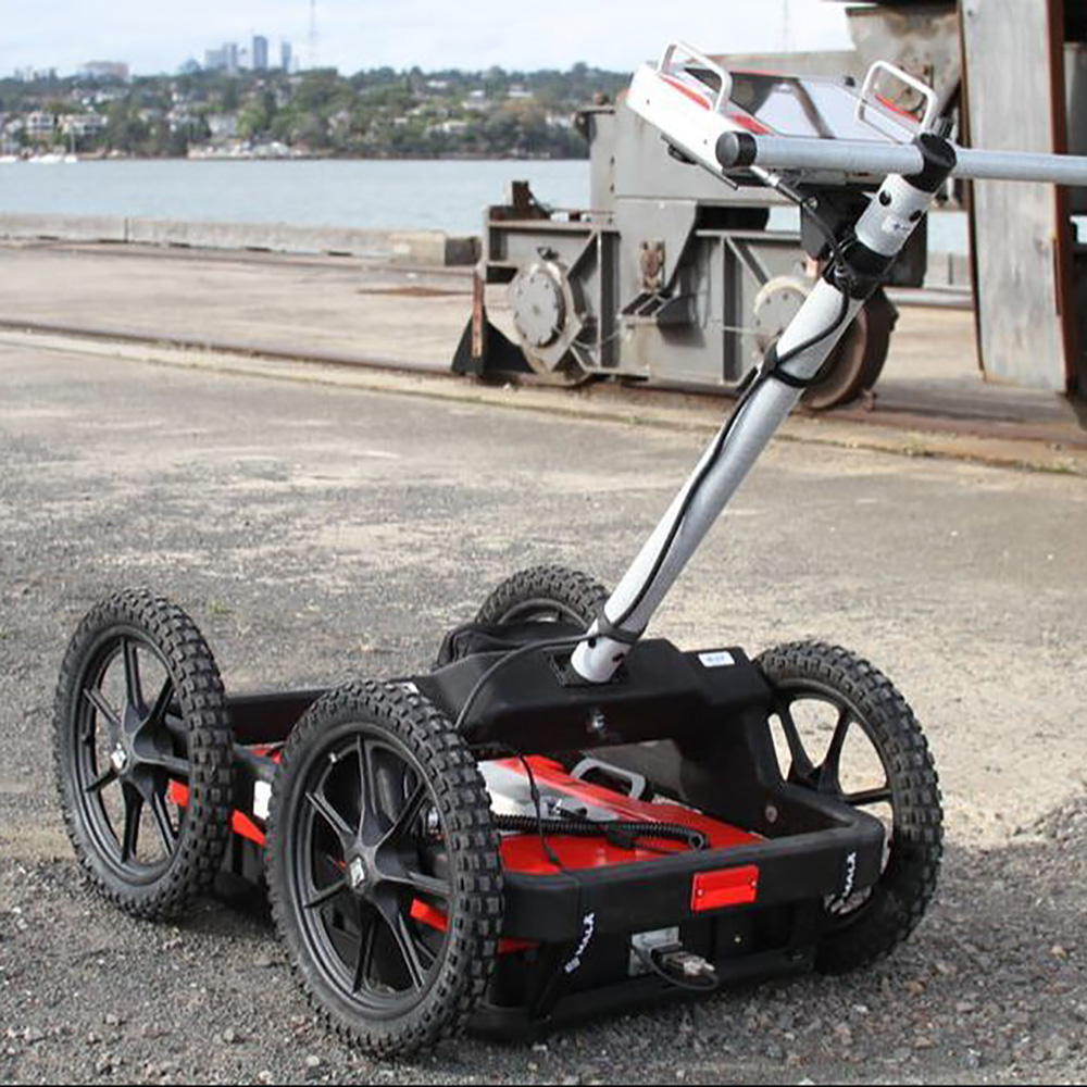
Underground Detection Services
- Detection of pipes
- Detection of cables
-
Clearance of monitoring well and borehole locations prior to
drilling
-
Clearing trenching positions for various construction
applications
- Service Detection and Surveying for design purposes
-
Marking identifies services out with spray paint on the
surface or with painted stakes
-
Brief detection report with photos of identified services
- Survey drawing in CAD formats